Create sophisticated, modular models to identify threats and assess pipelines, utilizing design, operations, maintenance, and assessment records or spatial data layers stored in your enterprise database.
RiskFrame® Modeler allows you to quantify and prioritize risk by bringing data together from across the organization into a customizable risk-modeling environment. Easily create complex risk algorithms using modular, individual threat and consequence models. Risk scores are generated for each dynamic segment along the pipeline ensuring the highest level of resolution into the risk results. Built-in data processing translates spatial feature classes into feature tables to be combined with other tabular data to evaluate pipeline risk. RiskFrame Modeler provides an interface allowing the user to combine business logic, engineering best practice, operational expertise, and asset management strategies into objective, documented, and repeatable assessment models. Reporting options allow you to extract and review data to develop risk and mitigation plans, with results shared for mapping and online analysis.
 ESRI APR Support (UPDM, PODS 7)
DataFrame ASG supports ESRI APR data models, including UPDM, PODS 7, or custom APR implementations.
 Audit Proven
RiskFrame Modeler has successfully passed regulatory scrutiny with numerous clients over many years. The success of RiskFrame Modeler comes from ability of users to defend and understand the risk modeling process, which provides transparency and justification to the risk results.
 Project-Based Analysis and Archival
RiskFrame Modeler uses a project concept to manage how models proceed, offering model filters that restrict an analysis to certain lines or systems. When models run, a project archive is updated with the results of that particular pass. Archived reports are stored at the enterprise level, which can be easily retrieved and reviewed. Users can also save the risk model report locally to distribute it to users who may not have access to the database or for inclusion in the integrity management plan.
 Results Mapping
Any factor formula within your risk model can be displayed, identified, sorted, symbolized, labeled and exported, allowing engineers to gain valuable knowledge of the spatial risk results without being a GIS professional.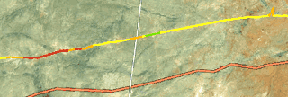
 Data Library
RiskFrame Modeler stands on top of an operator's enterprise database of defined tabular and spatial data sets. Incorporated is a spatial processing tool to translate spatial features classes into tables which become part of the same data library utilized throughout the organization. There is no need to manage multiple copies of data or systems of record. As new or data or assets are incorporated into the enterprise database, they are seamlessly integrated with the existing risk model
 What-If Scenarios
The net effect of any proposed change(s) in source data state can be modeled for any factor or formula within a risk model without editing the model or committing any actual changes. Running multiple scenarios provides quantifiable changes to threat or risk levels, providing objective justification of the most appropriate remediation activity by showing risk and expense mitigation. By displaying the original and potential model results records side by side, the What-If scenario report provides tools to directly measure the sensitivity of the risk model to integrity management practices.