Pipeline construction data management and mapping establishes the foundation for an asset database
GeoFields provides project data management and mapping services for all phases of pipeline construction projects. We provide survey procedures, survey data dictionaries and construction alignment sheets. Our approach is an efficient, reliable way to collect and manage GPS survey data supporting the design and construction of new and proposed pipelines.
 Data Dictionaries and
Survey Procedures
GeoFields provides specifications for data deliveries from survey contractors. Custom data dictionaries for use on a GPS or other survey tools are delivered for use on preliminary centerline surveys, civil surveys, environmental surveys, as-built surveys and other data collection activities. The data is integrated with the asset database for use with enterprise software and map output eliminating the cost for conversion from CAD to GIS at project completion.
Survey Procedures
Active management of the survey data collection process from contractors reduces the errors and omissions. Providing survey procedures to pipeline operators and their survey contractors allows survey crews to collect data efficiently in the field, and also provides clean data for future use in the enterprise database. The data can also be collected in a project database and output on construction sheets in a very short survey to sheet turn-around time.
Training
The training process helps contractors adhere to the specified survey procedures and data dictionary format so the survey data can be easily integrated into the project database, while also assuring that complete data is collected.
Data Dictionary
We provide GPS (or other survey tool) data dictionaries for preliminary centerline surveys, civil surveys, environmental surveys, as-built surveys and other data collection activities. A well-planned data dictionary that includes consistent field names, table structure, and content is crucial for deployment to data processing programs. By providing survey and environmental contractors with field data dictionaries, data collection training, and data processing procedures, the output files they provide are always consistent. The field data dictionary is instrument independent, allowing for position data to be collected by mapping grade GPS, survey grade GPS or total station survey instruments.
Survey Data Management
Management of survey data is achieved through the use of web-based project collaboration software. Survey teams access the web page from anywhere to post their daily survey files. The survey data is then integrated into the project database and available for construction sheet generation. Processed data is posted to the web page in composite files that can be used by survey contractors or other project team members for quality control checks or mapping applications
 Construction Alignment Sheets
Construction alignment sheets show all spatial and schematic related data collected during pipeline construction. We produce construction sheets to client specifications and since we use our own DataFrame ASG software, we are a fast, efficient and cost effective value for operators that do not have the resources or time to get the job done in-house. Sheet templates are designed with virtually unlimited flexibility and distributed to you as a batch production project or on-demand as you need them.
Custom Sheet Design
Sheet designs are flexible with unlimited variations in richly and precisely formatted sheets based on your needs. Sheets can be any size and can contain any number of bands with a large library of band types that are tailored to your specific needs.
Construction Bands
In addition to the standard bands on a typical alignment sheet, construction alignment sheets are able to display bands specific to the pipeline construction project.
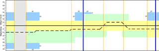 A ROW/temporary workspace band is used to display the temporary and permanent right-of-way configuration, temporary workspace, and additional workspace needed for the project. Additional band types that can be included are ownership band, environmental band, corrosion potential band and construction schematic bands.
Sheet Archive
Each rendition, or vintage, of the pipeline route is saved separately, and sheets from any previous version of the route can be easily generated. As a result, stakeholders are able to refer to any current or past pipeline routes.
Survey Data Integration
Construction sheet generation entails active management of the survey data collection process. Survey data is checked for quality (errors, omissions and completeness) and then incorporated into the database providing a central repository of project data. The data management process covers preliminary centerline and workspace, land, environmental, archaeological, corrosion, construction (civil), and eventually as-built surveys.
Custom Symbology
Our advanced symbology and labeling options are virtually limitless. Your sheets can use existing company symbology conventions as well as newer symbols that use full color and complex shapes. Symbols can vary in size, color and shape based on data properties such as inlet diameter, pipe specification, age, condition, etc.
Multiple Output Options
Press-quality sheet output is generated in batches or one at a time. In addition to traditional printed alignment sheets of any size, we offer digital output formats including PDF and Georeferenced PDF with embedded map data.